TSUNAMI
RUN-UP CHART and EVACUATION ROUTES
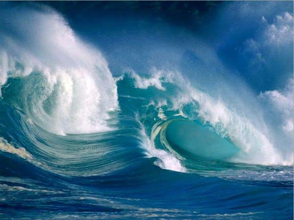
YOU HAVE 2 MINUTES TO GET 150 FEET UP!
Your attitude and altitude
will save you, your family, your pets and livestock.
They depend on you -
DON'T ABANDON THEM or LET THEM DOWN!
The Highest Surge Height The Japan Fukushima Tsunami Reached Was 112 Feet!
During the California North Coast Tsunami Alert on March 11 - 12, 2011 residents and
tourists in the town of Mendocino were being moved to elevations above 150 feet
up the Comptche-Ukiah Road. That way if the State Highway 1 bridges were knocked
out they could still drive inland to Hwy 101 to amenities and shelter.
Pacific Northwest Native American Story - 1700
"The water on its rise became very warm, and as it came up to the houses, those who had canoes put their effects into them, and floated off with the current, which set very strongly to the north. MANY OF THE CANOES CAME DOWN IN TREES and were destroyed, and numerous lives were lost. WE SPENT A COLD NIGHT IN THE HILLS, SURROUNDED BY ANIMALS WHO HAVE ALSO FLED THE FLOOD. The water was four days regaining its accustomed level."
YOUR GUESTS and YOUR LIABILITY
There is always a certain amount of skepticism and denial. However, there is a LIABILITY; especially if you own a BnB, Campground, Hotel, Motel, Retreat Center, Spa or Vacation Rental Home in the "Tsunami Zone".
Liability laws are based on common sense. "Foreseeable" is an important aspect of liability. Can this event be foreseen? YES it can. Will somebody be harmed? Possibly. Is there a DUTY to protect paying guests? YES! An innkeeper has a duty to protect their guests. Does an innkeeper have a duty to protect their guests from an Act of GOD. YES! if it is a foreseeable "Act of God" and there is something they can reasonably do about it. All innkeepers along the northern California coast have constructive knowledge that a Tsunami could come. They should have a plan for their guests to evacuate to safe ground. Will signs about the property or in the room describing the risk and evacuation route be sufficient - PROBABLY. In the event a earthquake generates a Tsunami they or their agents have a duty to wake their guests even at 3 am in the morning to help evacuate and save their lives. More conscious innkeepers know there are also the "Laws of Karma".
MARIN COAST (Coming Soon)
ELEVATONS. KILLING ZONES and SAFE ZONES -
SONOMA COAST
ELEVATONS. KILLING ZONES and SAFE ZONES -
It's not your atitude, but your altitude that will save you.
MENDOCINO COASTELEVATONS. KILLING ZONES and SAFE ZONES -
Here is Today's Weather, Today's Tide Chart, and Today's Nightime Star Chart. Road conditions and web cams can be viewed here: Web Cam on Mendocino's Main Street. The elevation of Mendocino is from 1 foot at Big River Beach to 150 feet at the historic hillside graveyard. Feel an earthquake? - You have 2 minutes to get 150 feet up (tsunami waves travel 600 mph) and the surge can reach 50 to 100 feet. The hill top Hill House Inn parking lot is 170 feet above sea level. Here is the Tsunami Early Warning System. Enjoy the "Mom & Pop" business's linked to and in some cases reviewed below. Be alert - travel with LOVE in your heart and you will be safe.
SEA RANCH - GUALALA KILLING ZONE
SEA RANCH - GUALALA SAFE ZONE
ANCHOR BAY - KILLING ZONE
ANCHOR BAY - SAFE ZONE
POINT ARENA - KILLING ZONE
POINT ARENA & ROLLERVILLE - SAFE ZONES
MANCHESTER - KILLING ZONE (Below 100 Feet)
and SAFE ZONE (Above 150 Feet)
on Hwy 1) turn right and up 2 Miles = 150 Feet
IRISH BEACH - KILLING ZONE
IRISH BEACH - SAFE ZONE
ELK - KILLING ZONE
ELK - SAFE ZONE
ELK - NAVARRO BRIDGE - KILLING ZONE
TIMBER COVE, CALIFORNIA - Late 1990's
"Rimpoche where in the cove is the Dragon King's head? Dragon King's head not here - it is off Washington. Washington Rimpoche?! Where is the Dragon King's tail? Dragon King's tail is off Mexico. What part of the Dragon King is in Timber Cove Rimpoche? Dragon Heart is here! Dragon King's Spirit Lives Here! (the Dragon King is the San Andreas fault).
ALBION SAFE ZONE
ALBION - ALBION FLATS KILLING ZONE
North side of Bridge go 1/2 Mile Up Albion-Little Lake Road = 200 Feet
LITTLE RIVER SAFE ZONE
LITTLE RIVER KILLING ZONE
MENDOCINO SAFE ZONE
MENDOCINO KILLING ZONE
There could be traffic jams so be prepared to evacuate on foot or by bicycle with a back pack. Go to the Hill House Inn or the Historic Graveyard
CASPAR- PINE BEACH SAFE ZONE
MENDOCINO NORTH - CASPAR - PINE BEACH KILLING ZONE
FORT BRAGG SAFE ZONE
FORT BRAGG KILLING ZONE
There will be traffic jams up Harbor Drive and Fort Bragg side streets as people flee east to the 150 foot elevations. Be prepared "to run for it like Forest Gump" or skateboard, ride a bicycle, ATV or motorcycle.
CLEONE SAFE ZONE
CLEONE KILLING ZONE
WESTPORT TO LOST COAST SAFE ZONE
WESTPORT TO LOST COAST KILLING ZONE
HUMBOLDT COAST (Coming Soon)
ELEVATONS. KILLING ZONES and SAFE ZONES -
DEL NORTE COAST (Coming Soon)
ELEVATONS. KILLING ZONES and SAFE ZONES -
WHAT TO LOOK FOR BEFORE A EARTHQUAKE and TSUNAMI HIT
Often months before a earthquake and tsunami hit, people start having mass dreams of large waves and a feeling of impending doom. A week before the quake hits ants start coming out of their burrows and relocating to higher ground. Pets get skiddish and can run away from home. People can feel more irritable than usual and uptight - especially in banks where their security is tied to survival. Twenty minutes before the quake hits cattle and horses will break and run to the tops of hills. Divers off shore suddenly find all the fish disappear and the currents became really strong. Then it happens - an earthquake triggers an under sea tsunami. Some feel the quake - others do not. A sense of calm envelopes the air as the sea rushes out exposing beaches, bay bottoms and the ocean floor "way out". Then a wall of white foam is seen on the horizon as a "perfect wave" appears in the distance. RUN! For some who were not "tuned in" it will be too late. There will be three to five large surges and waves. Do not be fooled by the calm after the first tidal wave, surge and run-up. EACH WAVE and inland surge GETS STRONGER AND HIGHER than the preseding one. This can go on for hours. "The sea had just come in turning my hotel into a boat, stated one tourist." USGS Geologist Jim Berkland has had several intuitive predictions and has painted a picture of a several"Sesmic Windows" from 2000 on.
If a earthquake of at least 9.0 happens on the Cascadia Subduction Zone and generates a Tsunami of the size Japan felt in March of 2011 it would be devastating to harbors and bays of northern California with a northwestern facing entrance. A large forest of huge redwood trees "broke off" and sunk beneath the sea off Humboldt several hundred years ago. Northwest facing harbors include Cresecent City Harbor in Del Norte County, Humboldt Bay, Noyo Harbor at Fort Bragg, Big River estero at Mendocino, Albion Flats and up the Navarro River, the mouth of the Russian River on the Sonoma County coast, Salmon creek estero and Tomales Bay in Marin County. Bodega Bay may or may not be badly affected - but many of the beaches and creek esteros and watersheds will.
Native American Legends of Giant Tsunami's and resultant ocean floods.
A Pacific Northwest Makah Legend (as accounted by Swan in 1868) states "The water on its rise became very warm, and as it came up to the houses, those who had canoes put their effects into them, and floated off with the current, which set very strongly to the north. Some drifted one way, some another; and when the waters assumed their accustomed level, a portion of the tribe found themselves beyond Nootka, where their descendants now reside, and are known by the same name as the Makahs in Classett, or Kwenaitchechat. MANY OF THE CANOES CAME DOWN IN TREES and were destroyed, and numerous lives were lost. The water was four days regaining its accustomed level."
Another interview accounted for by Deborah Carver (in Anderson, 1995) states, "A number of stories, including one from Washington state, tell of a huge earthquake occurring in the middle of the night, Deborah Carver said, in some cases after people in a doomed village have misbehaved. Elders tell the young that they must run for high ground. Those who heed their warning survive, although the 'flood' waters follow close behind them. THEY SPEND A COLD NIGHT IN THE HILLS, SURROUNDED BY ANIMALS WHO HAVE ALSO FLED THE FLOOD. In the morning they find that all traces of their village, and all neighboring coastal villages, have been completely washed away and no one else has survived."
"Among the signs of danger, the elders warn, is long-lasting shaking moving from west to east, and sand that becomes so loose people walking on the beach sink into it."
KASHAI POMO MEDICINE WOMAN'S VISION IN THE LATE 1890'S
"The Vision of a Kashai Pomo Medicine Woman in the late 1890's saw the ocean along the coast "on fire and all the fish were dead along the shoreline". The Kashai Pomo Indian tribe lives in the mountains above Stewart's Point, California near Sea Ranch.
TSUNAMI FOOTAGE
of NORTHERN CALIFORNIA and JAPAN
Tsunami waves generated by the Chilean earthquake kept coming for 20 hours. They were triggered when the seabed and water were raised by a massive amount of energy, created by movement along a 600-kilometer-long fault near Chile.
The highest recorded tsunami caused by an offshore earthquake occurred off Ishigaki Island in the Ryukyu chain on April 24, 1771. According to the Guinness Book of Records. it tossed an 830-ton block of coral more than 1½ miles inland and may have been as high as 279 feet.
In February 2010, the Pacific Coast of Japan was struck by a small tsunami generated by a powerful earthquake 17,000 kilometers—half a world away— in Chile that reached Japan the day after the earthquake occurred. Perhaps most remarkably the tsunami traveled 20 kilometers up a river that emptied into Sendai Bay. Tsunami expert Hitoshi Tanaka of Tohuku University told the Yomiuri Shimbun, “In the case of a gently inclining river, a tsunami can travel upriver for long distances and cause flood damage inland. Residents living near rivers have to be careful.”